 |
Earth Observation Mission CFI Software Pointing Software User Manual |
 |
 |
Earth Observation Mission CFI Software Pointing Software User Manual |
 |
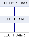
Class for the DEM parameters. More...

Public Member Functions | |
| DemId () | |
| Empty Class constructor. | |
| ~DemId () throw (CfiError) | |
| Class destructor. | |
| void | init (long mode, long model, const string demFile) throw (CfiError) |
| Initialise the DEM parameters. | |
| double | compute (const ModelId &modelId, double lon, double lat) const throw (CfiError) |
| Compute altitude over the sea level for a point in the Earth. | |
| SatId | satId () const |
| Get satellite id. | |
| DemConfFile | getData () const throw (CfiError) |
| Get DEM parameters. | |
| DemInfo | getInfo (const ModelId &modelId, double lon, double lat) const throw (CfiError) |
| Get DEM source data. | |
Protected Member Functions | |
| GenericId * | getId () |
| Get the id. | |
Class for the DEM parameters.
| EECFI::DemId::DemId | ( | ) |
Empty Class constructor.
| EECFI::DemId::~DemId | ( | ) | throw (CfiError) |
Class destructor.
References EECFI::CfiId::status(), EECFI::CfiId::subtractInstance(), and EECFI::CfiClass::throwWarn.
| double EECFI::DemId::compute | ( | const ModelId & | modelId, | |
| double | lon, | |||
| double | lat | |||
| ) | const throw (CfiError) |
Compute altitude over the sea level for a point in the Earth.
| modelId | Model id. | |
| lon | Longitude. | |
| lat | Latitude. |
| DemConfFile EECFI::DemId::getData | ( | ) | const throw (CfiError) |
Get DEM parameters.
References EECFI::CfiError::addMsg(), EECFI::DemConfFile::dataSize, EECFI::DemConfFile::dataType, EECFI::DemConfFile::dir, EECFI::DemConfFile::metadataModel, EECFI::DemConfFile::model, EECFI::DemConfFile::northAlt, EECFI::DemConfFile::offsetX, EECFI::DemConfFile::offsetY, EECFI::DemConfFile::resUnit, EECFI::DemConfFile::resX, EECFI::DemConfFile::resY, EECFI::DemConfFile::southAlt, EECFI::CfiClass::throwWarn, EECFI::DemConfFile::userDirectory, EECFI::DemConfFile::XNumPoints, EECFI::DemConfFile::xRange, EECFI::DemConfFile::YNumPoints, and EECFI::DemConfFile::yRange.
| GenericId * EECFI::DemId::getId | ( | ) | [protected] |
Get the id.
| DemInfo EECFI::DemId::getInfo | ( | const ModelId & | modelId, | |
| double | lon, | |||
| double | lat | |||
| ) | const throw (CfiError) |
Get DEM source data.
| modelId | Model id. | |
| lon | Longitude. | |
| lat | Latitude. |
References EECFI::DemInfo::dataSource, and EECFI::DemInfo::demModel.
| void EECFI::DemId::init | ( | long | mode, | |
| long | model, | |||
| const string | demFile | |||
| ) | throw (CfiError) |
Initialise the DEM parameters.
The altitude is calculated from the altitudes read from a digital elevation model (DEM).
| mode | Digital elevation model initialisation mode (DemModelPointingEnum). | |
| model | Digital elevation model initialisation model (dummy in current implementation). | |
| demFile | File used for DEM initialisation. |
| SatId EECFI::DemId::satId | ( | ) | const |
Get satellite id.
 1.7.1
1.7.1