
New Release Announcement - S2G v2.6.0
Version 2.6.0 of the S2G Data Viewer has been released and can be downloaded here.
Release Notes are available here.
User registration is required. Please find detailed instructions here.
New Features
- Allow multiple selection to close files in Product File panel (S2G-AN-257)
- Improve 'Jump to unit' and 'Jump to position’ dialogs (S2G-AN-259)
- Added progress bar to the Filtering feature (S2G-AN-262)
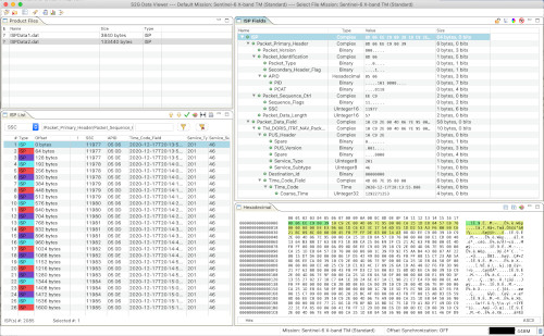
- Support additional time type to decode Sensing/Downlink Time in ISP annotations for FLEX (CDS_days_seconds_microseconds) (S2G-AN-268)
- Added progress bar to the Filtering feature (S2G-AN-262)
Software Aspects
- Porting of S2G to OpenJDK 11 (S2G-AN-260)
- Eclipse RCP updated to version 4.24 (S2G-AN-271)
- Built using DFDL4S v2.0.0
Corrections
- S2G not working in macOS Big Sur and above (S2G-AN-256)
- Transformation from Annotated ISP to ISP results in an empty file (S2G-AN-269)
- Corrected application version metadata on macOS (File—>Get Info) (S2GA-N-270)
New Mission Schemas
- FLEX X-Band
New Release Announcement - DFDL4S/++ Library v2.0.0
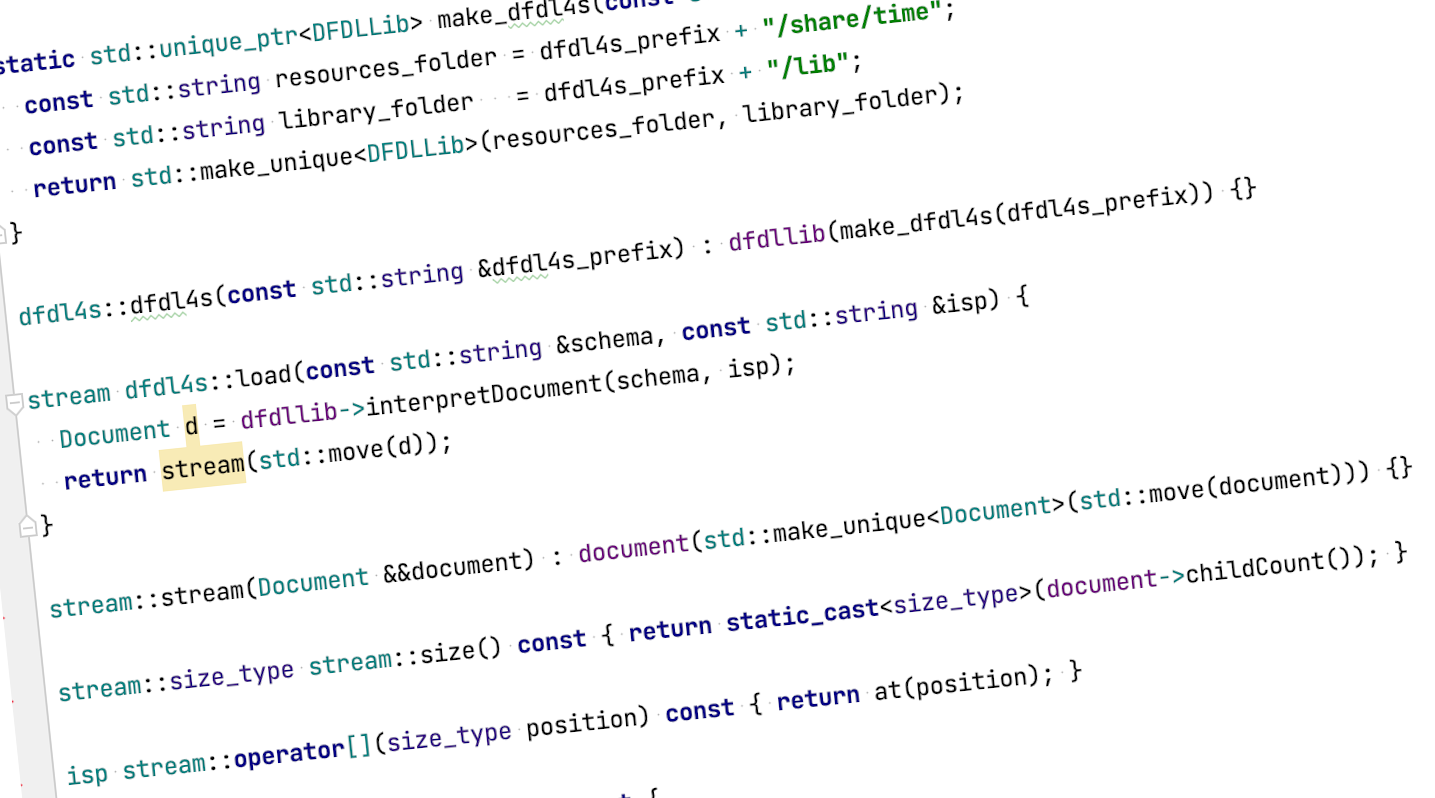
Version 2.0.0 of the DFDL4S Java and C++ Libraries has been released and can be downloaded here.
DFDL4S is a generic binary data binding library written in Java and based on the Data Format Description Language (DFDL). DFDL++ provides the same functionality exposing a native C++ API. See more details here.
The following is a summary of the changes in version 2.0.0.
New Functionality and Improvements
- Upgraded DFDL4S to Java 11 (also compatible with the latest Java 17 LTS release)
- Added support for custom CDS time code fields (days, seconds, microseconds)
- Updated statement of compliance with the latest DFDL standard available [documentation]
Release Notes for can be found here.
User registration is required. Please find detailed instructions here.
New Release Announcement - EOMER v2.0.7
Version 2.0.7 of the EOMER 2D/3D orbit and swath visualisation tool has been released and can be downloaded here.
Release Notes are available here.
User registration is required. Please find detailed instructions here.
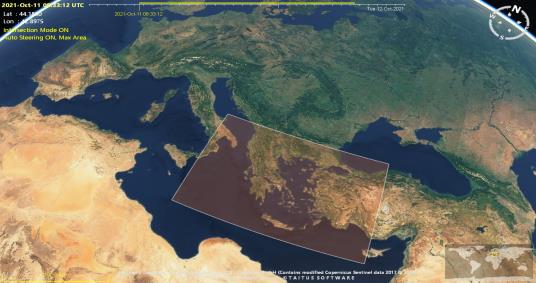
New Features
- Interoperability with other tools / file standards:
- Import / Export of ESOV NG Swath Control Files
- Support for Swath Definition File (fixed swath and nominal attitude sections)
- Support for CCSDS orbit files OEM, OPM, OMM
- Improvements to Report:
- Added the longitude of ascending node for each visibility pass
- Added functionality to estimate on-board recorder occupancy profiles taking into account data-takes planned and downlink plans to ground stations
- Generation of satellite-to-satellite visibility timelines and evolution viewing angles (azimuth and elevation plots), taking into account field-of-view masks
- Dedicated EOMER Help available via Eomer menu Help and online (see link)
Corrections
- Use ANX longitude and ANX MLST as driving parameters to calculate the ANX UTC time
- Report: Orbit column sorted by orbit number instead of by string
- Start-up error: “Coverage Satellite orbit not valid”
- Earth Map does not display textures
Updated Mission Configuration
- General update of mission configuration file (mission configuration update mechanism triggered by default at start-up)
New Mission Schemas Available: FLEX
New mission schemas are available for S2G Data Viewer and DFDL4S library.
The mission schemas can be downloaded through the check for updates mechanism within S2G (Help--> Check for Updates) or obtained from the S2G mission schemas page
New Mission Schemas
- FLEX X-band v1.0.0
Support includes decoding of (Scrambled) CADU, Transfer Frames and the following Instrument Source Packets:
- FLORIS Instrument Science Packets (decoded up to Data Field Header)
- Satellite Ancillary Packets: INST_TM, SAT_TM, PDHU_HK_TM, ICU_HK_TM (decoded up to Data Field Header)
- Satellite Ancillary Packets: NAVATT (fully decoded)
- GNSS Packets (decoded up to Data Field Header)
Page 11 of 37