Earth Observation Mission CFI Software Visibility Software User Manual |
Earth Observation Mission CFI Software Visibility Software User Manual |
Class that stores the Swath data. More...
Public Member Functions | |
| SwathId (AtmosId &atmosId, SwathInfo &swathInfo) | |
| Class constructor. | |
| SwathId (SwathId &other) | |
| virtual | ~SwathId () EXCEPT |
| Class destructor. | |
| SwathIdData | getData () const |
| Get swath data. | |
| void | setData (const SwathIdData &swathInfo) |
| Set swath data. | |
| SwathId & | operator= (const SwathId &other) |
| ZoneCoverageOut | zoneVisTimeCoverage (const ZoneCoverageIn &input) const |
| The zoneVisTimeCoverage method computes the portion of the input zone that is covered by the input satellite in input time visibility segments. | |
| void | computeAoi (const OrbitId &orbitId, const VisTimeInterval &timeInterval, double min_lon, double max_lon, double min_lat, double max_lat, double lon[4], double lat[4]) const |
| Compute the area of interest (aoi) based on SDF file and time interval. The function provides the pre-calculation of an area of interest (aoi), which is defined by min/max lon/lat that includes the projection of all segments from the satellite to the intersection with the ellipsoid. | |
Protected Member Functions | |
| void | eraseObject () |
| Close swath id of object. | |
Class that stores the Swath data.
Class constructor.
| atmosIdIn | Atmos id. | |
| swathInfo | Swath data. |
References EECFI::CfiId::addInstance(), EECFI::SwathInfo::filename, EECFI::SwathInfo::nofRegenOrbits, EECFI::SwathInfo::sdfFile, EECFI::SwathInfo::stfFile, EECFI::CfiClass::throwWarn, and EECFI::SwathInfo::type.
| EECFI::SwathId::SwathId | ( | SwathId & | other | ) |
Copy constructor.
| other | The SwathId to copy from |
| EECFI::SwathId::~SwathId | ( | ) | [virtual] |
Class destructor.
References eraseObject().
| void EECFI::SwathId::computeAoi | ( | const OrbitId & | orbitId, | |
| const VisTimeInterval & | timeInterval, | |||
| double | min_lon, | |||
| double | max_lon, | |||
| double | min_lat, | |||
| double | max_lat, | |||
| double | lon[4], | |||
| double | lat[4] | |||
| ) | const |
Compute the area of interest (aoi) based on SDF file and time interval.
The function provides the pre-calculation of an area of interest (aoi), which is defined by min/max lon/lat that includes the projection of all segments from the satellite to the intersection with the ellipsoid.
| swathId | Swath Id. | |
| time_interval | Time interval. | |
| min_lon | Minimum input longitude. | |
| max_lon | Maximum input longitude. | |
| min_lat | Minimum input latitude. | |
| max_lat | Maximum input latitude. |
References EECFI::CfiError::addMsg(), EECFI::VisTime::msec, EECFI::VisTime::orbitNum, EECFI::VisTime::sec, EECFI::CfiId::status(), EECFI::CfiClass::throwWarn, EECFI::VisTimeInterval::tstart, EECFI::VisTimeInterval::tstop, EECFI::VisTime::type, and EECFI::VisTime::utcTime.
| void EECFI::SwathId::eraseObject | ( | ) | [protected] |
Close swath id of object.
References EECFI::CfiId::status(), EECFI::CfiId::subtractInstance(), and EECFI::CfiClass::throwWarn.
Referenced by operator=(), and ~SwathId().
| SwathIdData EECFI::SwathId::getData | ( | ) | const |
Get swath data.
Copy assignment operator.
References EECFI::CfiId::addInstance(), and eraseObject().
| void EECFI::SwathId::setData | ( | const SwathIdData & | swathInfo | ) |
Set swath data.
| swathInfo | Swath id data. |
References EECFI::SwathIdData::filename, EECFI::SwathIdData::nofRegenOrbits, EECFI::SwathIdData::orbitRef, EECFI::SwathIdData::sdfFile, EECFI::SwathIdData::stfFile, EECFI::SwathIdData::type, EECFI::SwathIdData::valOrbitStart, and EECFI::SwathIdData::valOrbitStop.
| ZoneCoverageOut EECFI::SwathId::zoneVisTimeCoverage | ( | const ZoneCoverageIn & | input | ) | const |
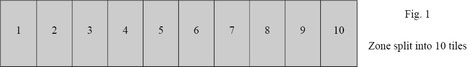
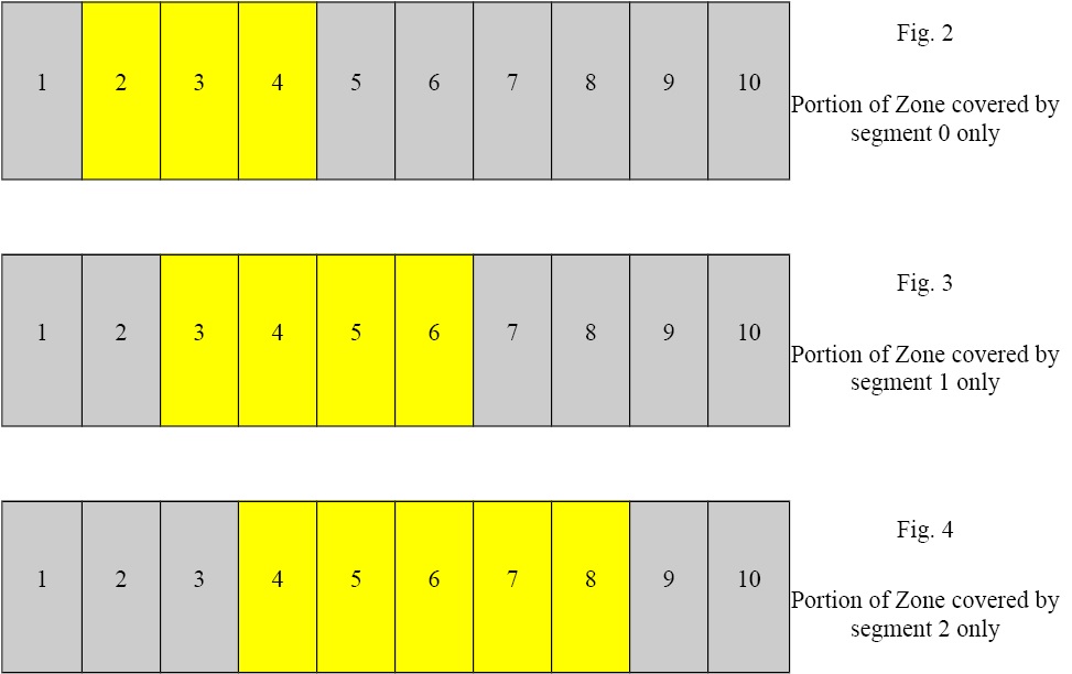
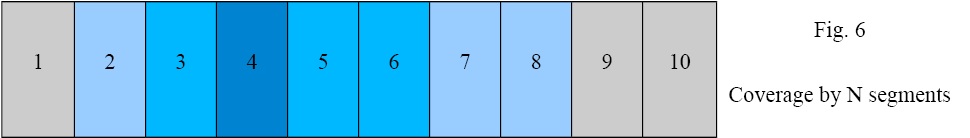
The zoneVisTimeCoverage method computes the portion of the input zone that is covered by the input satellite in input time visibility segments.

| input | Inputs for zone coverage computation. |
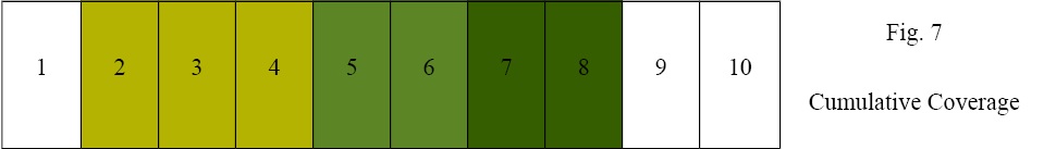
References EECFI::ZoneCoverageOut::coverageByNIntervals, EECFI::ZoneCoverageOut::coveragePerInterval, EECFI::ZoneRec::creator, EECFI::ZoneCoverageOut::cumulativeCoverage, EECFI::ZoneRec::description, EECFI::AttitudeDef::instrTransId, EECFI::ZoneInfo::minDuration, EECFI::ZoneCoverageIn::percentPrecision, EECFI::ZoneCoverageIn::pointGeodDistance, EECFI::ZoneRec::projection, EECFI::ZoneInfo::projection, EECFI::AttitudeDef::satNomTransId, EECFI::AttitudeDef::satTransId, EECFI::CfiId::status(), EECFI::ZoneRec::surface, EECFI::CfiClass::throwWarn, EECFI::ZoneCoverageOut::totalCoverage, EECFI::ZoneInfo::type, EECFI::AttitudeDef::type, EECFI::ZoneCoverageIn::typeCoverage, EECFI::ZoneCoverageOut::zoneArea, EECFI::ZoneInfo::zoneData, EECFI::ZoneInfo::zoneDBFilename, EECFI::ZoneRec::zoneDiam, EECFI::ZoneRec::zoneId, EECFI::ZoneInfo::zoneId, EECFI::ZoneRec::zonePoint, and EECFI::ZoneRec::zoneType.
 1.7.1
1.7.1