New Mission Schemas Available: Biomass
New mission schemas are available for S2G Data Viewer and DFDL4S library.
The mission schemas can be downloaded through the check for updates mechanism within S2G (Help--> Check for Updates) or obtained from the S2G mission schemas page
New Mission Schemas
- Biomass X-band v1.0.1
The following Instrument Source Packets types are decoded:
- Instrument Science Packets
- Instrument Ancillary Packets (both RXM-H and RXM-V)
- Platform Ancillary Packets
New Release Announcement - EOCFI v4.21
Earth Observation Mission CFI Software v4.21 has been released!
The latest version can be downloaded here with the detailed release notes available here.
User registration is required. Please find detailed instructions here.
The following is a summary of new features and problems solved in Version 4.21.
New Features & Improvements
- Optimisation of EOCFI library size
- EOCFI C reduced from ~1.5GB to ~210MB
- EOCFI C++/JAVA reduced from ~150MB to ~60MB - Optimisation of precise propagator runtime performance
- runtime improved by 100x - Enabled use of custom SP3 satellite identifiers
- Optimisation of memory used by DEM tile cache depending on height type
- only the strictly necessary memory is used for int16/32/64 and float32/64 pixel size - Enabled loading of overlapping Attitude data files
- Optimisation of loading orbit data with time/orbit number filtering in xd_read_orbit_file/xo_orbit_init_file
- Enabled Model parameters specification using both numerical and textual values in Attitude and Swath definition files
Bug Fixes
- Corrected calculation of Target-to-Sun visibility flag
- Corrected “maximum iterations reached” error in xo_position_on_orbit_to_time
- Corrected memory leaks when loading IERS bulletins in xl_time_ref_init_file
- Corrected failure to compute valid solution in xp_target_range
- Corrected memory leaks when using precise propagation in xo_osv_compute
- Corrected internal memory management that caused EOCFI Java examples to crash on Windows
- Corrected LoS intersection with DEM calculation that resulted in occasional positive/negative height spikes
- Corrected memory leaks related to copy constructors/destructors in EOCFI C++
- Corrected calculation of absolute orbit number when initializing orbit with EOM file
- Correct handling of Fixed Header in EOCFI Java (i.e. ensure all fields where properly set)
- Correct rotation matrix to quaternions calculation that returned NaN
- Correct critical failure when calling xv_timesegments_compute_* function with uninitialized Orbit Id
- Correct handling of -fit_mode and -tstep options in gen_tle tool
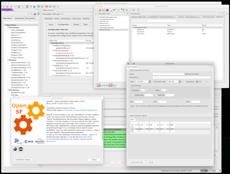
New Release Announcement - OpenSF v3.10.0
OpenSF v3.10.0 has been released and can be downloaded here.

User registration is required. Please find detailed instructions here.
New Features and Improvements
-
Added support for local storage to replace use of MySQL
- MySQL is no longer a requirement to run an E2E Simulation with OpenSF
- Enabled support for latest version of MySQL (8.0) and Maria DB (10.5.2)
- Added support for CLI based on options (as per ESA Generic E2E Simulation ICD 1.4.0)
- Enabled support for modules without input/output files/folders
- Enabled support for Modules using only Global Configuration
- "Using Docker in OpenSF Simulations" tutorial added to the User Manual
- Enabled explicit warning about use of parameter iteration in time-driven sessions
- Enabled use of commas in String typed parameters in Parameter Editor
- Upgraded to latest ESA Community License (Permissive)
Corrections
- Improved sanitization of command line options passed to the modules
- Corrected suffix of Database XML export files
- Corrected resolution of relative path for Module executable
All Release Notes are available here
New Release Announcement - OSFI v3.6.0 & OSFEG v1.4.2
OSFI v3.6.0 has been released and can be downloaded here.
Changes
- Upgraded to latest ESA Community License (Permissive)
- Added support for CLI based on options
- Enabled support for modules without input/output files/folders
- Enabled support for Modules usi only Global Configuration
Release Notes are available here.
OSFEG v1.4.2 has been released and can be downloaded here.
Changes
- Upgraded to latest ESA Community License (Permissive)
Release Notes are available here.
ESA generic E2E simulator ICD v1.4.0 Issued
ESA generic E2E simulator Interface Control Document (v1.4.0) has been published and can be downloaded here.
The updated document improves the CLI specification to allow more robust and flexible invocation (including support for optional configuration, input and output files) by a compliant orchestrating framework, such as openSF.
Page 9 of 31
